Data-Bound Vector Tile Layers
(Available from version 1.0.5.0)
Vector tile layers are an effective way of displaying large numbers of complex polygons on the map.
As well as supporting data-bound ArcGIS feature layers, Icon Map Pro also supports vector tile layers hosted in ArcGIS. Up to five layers can be specified to be displayed simultaneously, or one at a time via Power BI's drill-down functionality. Tile layer URLs can be specified using Power BI's conditional formatting so an unlimited number of vector tile layers can be switched between using a Power BI slicer, or driven from your data context using a DAX measure.
Vector tile attributes can be used to match features against data in your Power BI dataset to enable cross-filtering, highlighting and conditional formatting.
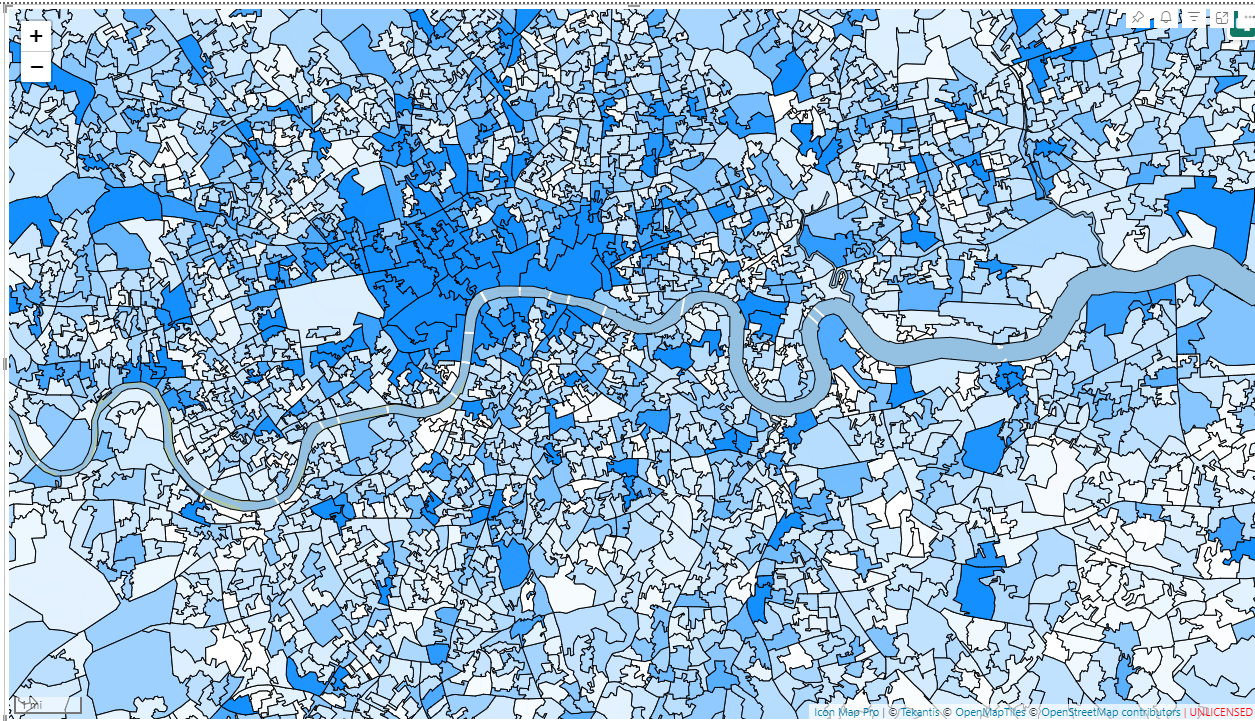 Source: Office for National Statistics licensed under the Open Government Licence v.3.0, Contains OS data © Crown copyright and database right 2024
This functionality is available when using a client ID and client secret to authenticate against ArcGIS.
To add your vector tile layer to Icon Map Pro, first locate your tile layer in the My Content area of the ArcGIS portal. Select it to view the details page for the layer.
Scroll down to locate the URL and copy it to the clipboard:

Paste it as the Vector Tile XYZ URL in the vector tile configuration settings in Icon Map Pro:
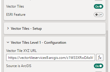
Ensure you have the ArcGIS authentication already configured, and the Source is ArcGIS setting enabled for that layer.