Reference Layers from ArcGIS Feature Layers
Icon Map Pro enables you to add up to five static reference layers from Icon Map Pro feature layers.
 Source: Office for National Statistics licensed under the Open Government Licence v.3.0, Contains OS data © Crown copyright and database right 2024
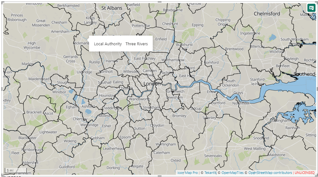
This example being from the Office for National Statistics in the UK using the following URL https://services1.arcgis.com/ESMARspQHYMw9BZ9/arcgis/rest/services/Local_Authority_Districts_May_2024_Boundaries_UK_BGC/FeatureServer/0
Other layers such as circles, heatmaps, data-bound feature layers, shape files, H3 cells etc can all be plotted over ArcGIS reference layers.
Formatting
ArcGIS Reference Layers can be formatted within Power BI to set the fill color and transparency, the outline color and transparency, the dash pattern of lines and line width. Each layer can be independently configured.
Conditional Visibility
It is possible to use Power BI's conditional formatting to set whether a layer is visible or not according to either values in your data, or a Power BI filter or slicer.
It is also possible to define the range of zoom levels that a layer is visible within.
Auto-Zoom
ArcGIS features can be included in the maps' auto zoom to ensure that all features are always visible on the map, when other data-bound items are being sliced or filtered.
Tooltips
It is possible to expose one or all of the features's properties within the layer as standard Power BI tooltips.